
The city has cooler climatic conditions throughout the year however, its recent weather patterns have shown a mismatch between extremely hot days with sudden heavy downpours. The town has sporadic showers amidst dry heat periods experienced for most of the year. However, there has been an exceptional increase in both heat waves and rainfall in terms of frequency and intensity lately. This is a result of global climate change causing regional weather changes. Sometimes due to such factors as convective energy build-up and moisture content within the atmosphere, warm spells can generate thunderstorms. Therefore, whenever there are expected heavy rainfall signs that can cause problems for people living along rivers or floods should occur, the meteorological department usually issues a “yellow alert”. Understanding these dynamics is crucial for preparedness and adaptation measures in the face of increasingly unpredictable weather patterns in Bengaluru.
Bengaluru Weather Forecast:
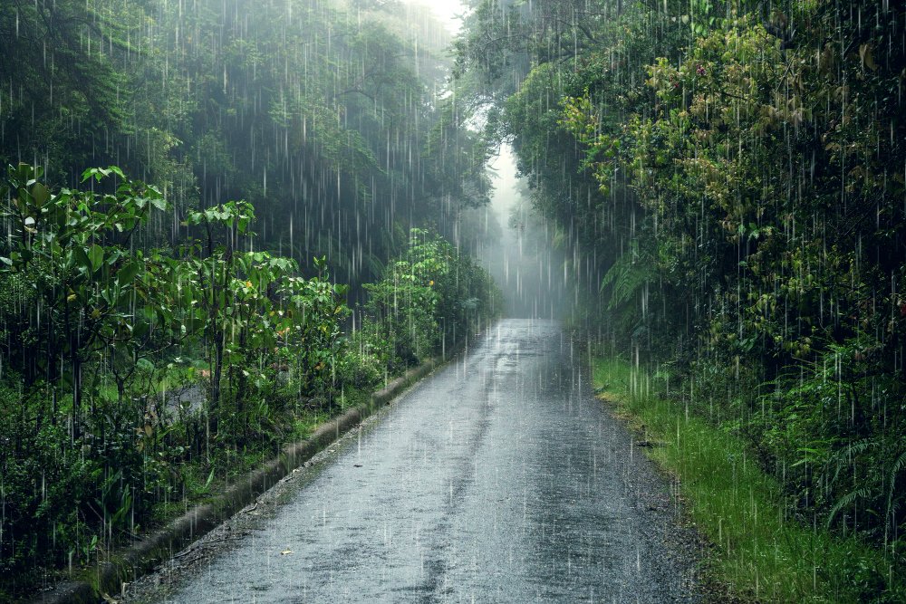
In Bengaluru, this climate translates into the rains setting in typically from June to September every year. Presently, the town is hot and sometimes wet with the moderate to heavy rains expected in the next few days as per the Met Department yellow warning system.
For example, heat waves usually turn out to be Thunderstorms caused by certain atmospheric conditions such as increasing surface temperatures leading to instability within lower atmospheric layers which form cumulonimbus clouds. When warm air near the surface rises with increasing temperatures, it creates instability in the atmosphere, resulting in cumulonimbus clouds. These towering clouds bring relief from the heat in the form of thunderstorms, accompanied by rainfall and lightning.
Throughout the next few weeks, Bengaluru will see fluctuating temperatures as well as thunderstorms that are accompanied by rainfall. This forecast should be communicated because high water levels may lead to severe flooding and traffic disruptions, especially during heavy rainfalls. It is thus important to follow advisories given out by the meteorological department and check local news updates during monsoon season.
What is a Yellow Alert For Rain?
A Yellow Alert for rain in Bengaluru represents a possibility of moderate or heavy downpours within hours or a day ahead. Such a condition may result in localized flooding, increased traffic congestion and power failures that might occur. In comparison with Green (no alert), Orange (heavy rain warning) and Red (extreme rainfall), it denotes carefulness advising people to remain aware of their surroundings, bind down loose items, and keep away from low grounds. Among other factors influencing its issuance is the intensity of rainfall overnight duration and probable impact on infrastructural properties like buildings breaking apart having weakened by water since bridges collapse when their piers are washed out too. Therefore, Bangalore residents ought to take heed of advisories and monitor weather updates while ensuring the ready availability of emergency kits.
Bengaluru faced the driest April in 41 Years:
Bengaluru in April of 2016 faced its driest month in four decades one with a very significant rainfall deficit and higher temperature averages. Among these droughts, this current dry spell stands out as the most severe by a great margin against historical records. The occurrence of El Nino effects, delayed onset of monsoons and others may be some possibilities that led to such a situation. There is also an impact on water supply and agriculture as well causing concerns about water scarcity as big crop failures have happened. Thus, residents are keenly monitoring this situation along with the concerned authorities who would otherwise rely more on yellow alerts on rains besides weather forecasts always coming in handy. When heatwaves become too much to bear, there is a need to know the atmospheric conditions behind thunderstorms that offer relief from the dry season.
Why does a heatwave always end with a thunderstorm?
Also, it is during a heatwave when the earth’s surface becomes intensely heated warming up the air above it. As it rises it creates low pressure area. This finally forms clouds after which they ascend cooling down. This sudden ascent followed by a quick cool down results in unstable atmospheric conditions which favor thunderstorm formation. In addition to this, moisture from nearby sources adds up to instability thus fueling the development of thunderstorms. For instance, in Bengaluru, recent instances of heatwaves often culminate in thunderstorms as seen from the pattern of intense heat followed by heavy showers that are marked by yellow alerts for rain being issued.
Atmospheric conditions for thunderstorms to form?
Thunderstorms in Bengaluru typically form when moist, warm air rises rapidly, often triggered by the convergence of different air masses, such as a cold front. The warm air rises, cools, and condenses into clouds, releasing latent heat, further fueling the updrafts. Moisture, instability, and a lifting mechanism are crucial. Bengaluru’s topography, nestled between the Western Ghats and the Deccan Plateau, can enhance moisture convergence and lift, aiding thunderstorm development. Additionally, urban heat islands can intensify local convection.
FAQs:
High temperatures, low humidity, and stagnant air masses cause most heat waves in India.
For precautions against heatwaves, one needs to stay hydrated, ensure staying indoors during peak hours of scorching sun, use fans or air conditioners and wear light clothes with lighter colours.
The hottest city on Earth is usually said to be Ahvaz, Iran where extreme highs are reached especially in summer.